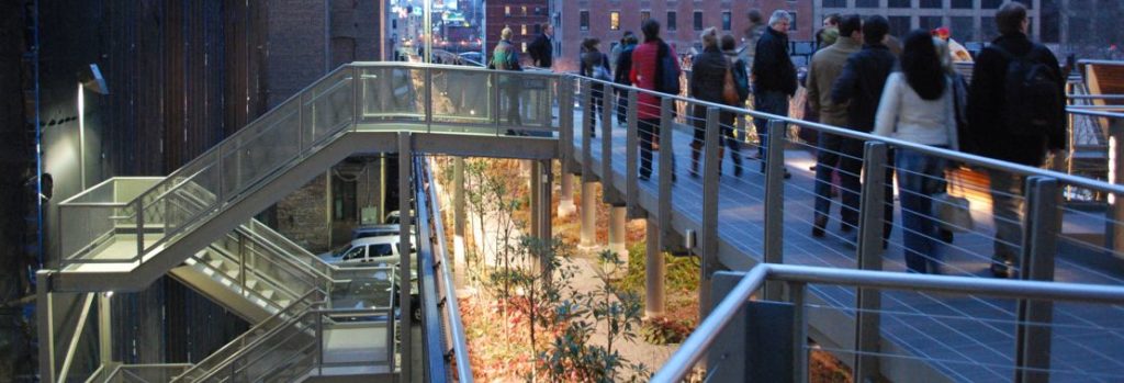
A Comparison of the Three Phases of the High Line, New York City: A Landscape Architect and Photographer’s Perspective
“A Comparison of the Three Phases of the High Line, New York City: A Landscape Architect and Photographer’s Perspective” compares Phase One with Phase Two, and describes what is proposed for Phase Three. Design features to be reviewed include the walk system, seat furnishings, plantings, signage and graphics, water feature and drinking fountains, public art, lighting, maintenance and irrigation, and Phase 3. The author also offers suggestions on economic impacts, restrictions and user activities, sustainability, and studies/research.
Originally, due to the length and photo essay nature of the contribution, the series was presented approximately every few weeks in 14 parts between 2013 and 2015; to ensure background information, the Series Introduction is repeated on all.
Part 13 – Phase Three As-built
By Steven L. Cantor, Landscape Architect – Originally Posted January 15, 2015
All Photos © Steven L. Cantor
Series Introduction
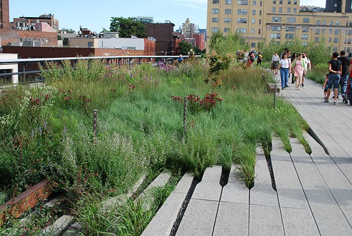
Phase One High Line on July 15, 2009.
Designed by landscape architect James Corner of Field Operations, architect Ricardo Scofidio of Diller Scofidio + Renfro with planting design by Piet Oudolf, the High Line, the remarkable linear park built on an abandoned railroad viaduct in New York City, has been enormously popular.
The design team anticipated how well green roof technology would function and adapt to the viaduct since it could handle at once the huge weight of several fully-loaded trains carrying heavy tonnage. As an intensive green roof, it has very few structural load limits which would curtail use. At peak use times there can be lines of pedestrians waiting to enter with as many as 20,000 visitors per day on weekends.[1]
The High Line has won numerous awards, and in particular several as a green roof, for example, in 2013 and 2010 from the American Society of Landscape Architects, Green Roofs for Healthy Cities in 2011, and in 2010 from the International Green Roof Association. This is a rare public project in which the success of the initial phase contributed to a high level of funding for subsequent phases.
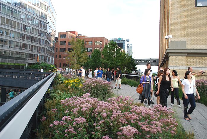
7.16.11.
The High Line has benefited from intense scrutiny as a result of lectures in which the designers were questioned; public hearings, media critiques in newspapers, journals, and blogs; lobbying from specific organizations, such as the Rainforest Coalition; and comments from city government and other public officials.
Improvements or adjustments were implemented to some design elements of the first phase, and significant modifications were done in the second phase. Are these changes aesthetic, appropriate and ethical, and are they consistent with the goals of sustainability? Is the High Line a sustainable design?
Part 13: Phase Three As-built Discussion
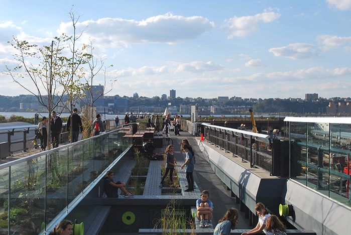
A view looking west over the Pershing Square Play Area on 10.08.14.
The third phase of the High Line opened September 21, 2014, and extends the High Line from the previous terminus above West 30th Street around the far west side of the Hudson Yards — the vast network of railroad tracks over which a huge private real estate development is slowly taking shape — to West 34th Street across from the Jacob Javits Convention Center. I’ve walked this new section a few times now in both directions. It seems most logical to guide the reader from the entrance on West 34th Street and end this description where the High Line joins the previous end of the second phase.
The addition is a distance of approximately a third to a half of a mile (0.53 to 0.80 kilometers), making the total length of the High Line from West 34th Street to Gansevoort about 1.5 miles or about 2.4 kilometers. At least half of this new stretch (one can say that it’s a work in progress) is an Interim Walkway and it’s designed as such with the use of a flexible pavement material which could easily be transformed as elements of the Hudson Yards are constructed and the intersections of these two designs are advanced.
It’s as if the third phase of the High Line is a giant umbilical cord around which the Hudson Yards will gradually evolve. As the different parts of the body take shape, many details about the vital artery may change as well.
The High Line begins on the south side of West 34th Street about two-thirds of the way between 11th Avenue and 12th Avenue (the West Side Highway) across the street from the side of the massive Jacob Javits Convention Center. It’s disappointing that there’s not a strong connecting link between the two, like a soaring pedestrian bridge that actually arrives at the Convention Center, for example, as now occurs at Millennium Park in Chicago where a graceful pedestrian bridge connects Renzo Piano’s new wing of the Chicago Art Institute over the heavily-trafficked street below to the park proper.
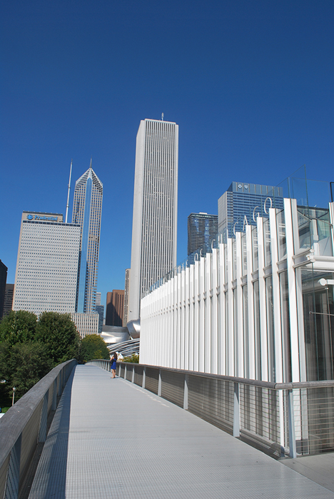
Two views of the soaring pedestrian bridge that links Millennium Park with a new wing of the Art Institute of Chicago across a busy street; 9.26.14.
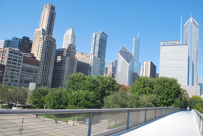
However, as future planning occurs for the convention center area, it’s certainly possible that something more imaginative might be conceived and implemented. To develop a graceful connection would be a challenge, nevertheless, as the side of the convention center closest to 11th Avenue is recessed about a story below the street so that the entrance is at a basement level.
About two thirds of the way towards 12th Avenue the retaining wall gradually lessens in height and there is side entrance to the convention center which is almost directly across the street from the entrance to the High Line, but creating a major crosswalk with pedestrian signalization would be a major undertaking since West 34th Street is heavily trafficked. Also, the main entrance to the convention center is off 11th Avenue so creating a major entrance at a side street might not be architecturally feasible.
The Interim Walkway is described as follows on signs:
“The opening of the High Line at the Rail Yards completes the northernmost phase of the park, connecting Gansevoort Street to 34th Street. Unlike the High Line to the south, this section features a simple path through the existing self-seeded plantings. The design celebrates the iconic urban landscape that emerged after the trains stopped running and highlights the expansive views of the Hudson River to the west and the City to the east. There are limited amenities in this section. Public restrooms are located at 16th Street and Gansevoort Street.”
This statement is accurate as far as it goes; no mention is made of elevator access, and despite the simpler design vocabulary that is implemented, it is unfortunate that there are no restrooms provided for what amounts to the first full mile of the High Line, that is until West 16th, which was part of Phase One. Throughout the Interim Walkway, the railroad rails are flush with the aggregate pavement so are certainly visible, but recessive within the design.
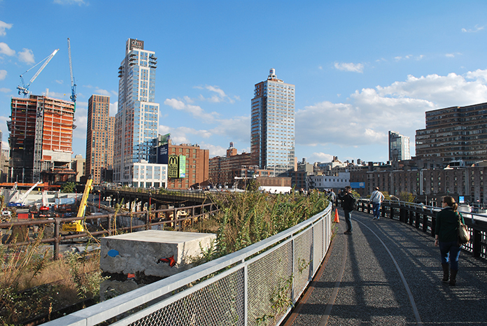
Looking south and east from the Interim Walkway with Hudson Yards under construction and sculpture by Adrian Villar Rojas; 10.08.14.
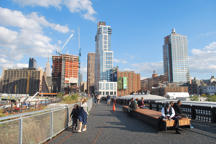
Looking east along the Interim Walkway where it starts to parallel West 30th Street; 10.08.14.
At West 34th Street there is a gated entry with clear signage and a large stacked wood bench and gathering area from which the High Line slowly ascends to the height of the railway trestle over a long graceful curving route which then parallels the West Side Highway until West 30th Street. There are signs noting that the site is still a “construction zone” and occasionally there are warning signs and roped off areas, or places where work is obviously underway and not finished.
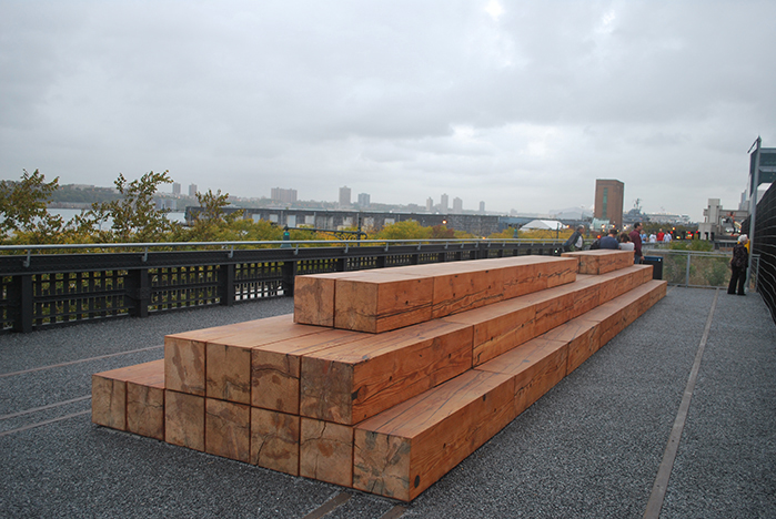
A view looking north of the Interim Walkway with one of large scale bleacher style benches; 10.15.14.
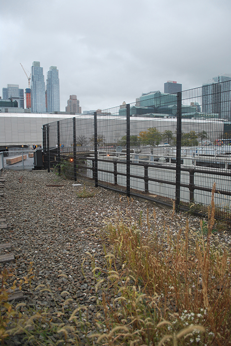
The Interim Walkway looking north with self seeded plantings in the foreground and bare areas yet to become vegetated; 10.15.14.
The design is simple with a continuous, black to dark gray aggregate pavement for two thirds of the width of the walk, and the remaining one third or less, the wild, self-seeded plantings. There are some areas particularly nearer to West 34th Street where coarse gravel and railroad ties have been exposed and restored but no self-seeding has occurred as yet. Much of this section of the High Line appears raw. Walking this section, one feels quite exposed to the elements at the same time that impressive views are afforded of the Hudson River and West Side Highway, the rail yards, and the skyline of the city.
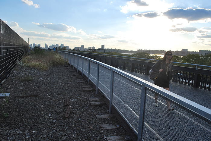
Looking south on the Interim Walkway. With the sun behind some clouds the landscape can appear quite dark and shaded even though one is walking in a wide open space. 10.08.14.
In keeping with the vast scale of the rail yards, the Interim Walkway is punctuated by large scale seating areas of stacked lumber and decorated with railroad frogs and other elements on either side of the walk. The handrail on the pedestrian side has been restored and clad with a modern treatment, although it’s lacking the LED lighting fixture that’s a signature element of the two earlier phases. There is a striking contrast between the sleeker, decorative treatment and the still-in-place old, rusted guardrail on the “wild” side.
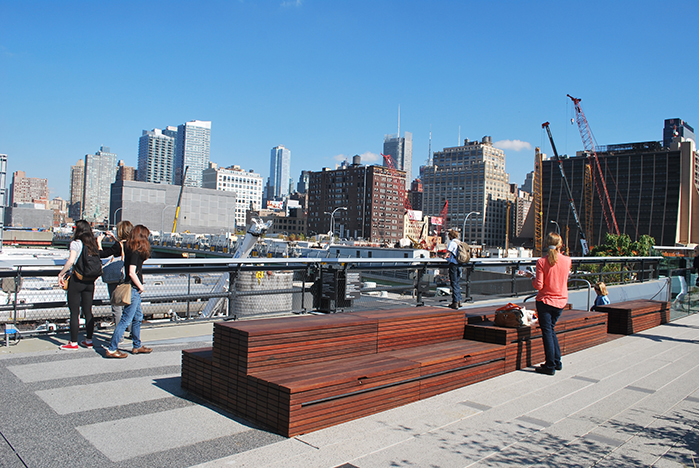
Large scale wood bleachers at the entrance to the Pershing Square Beams Play Area; 10.17.14.
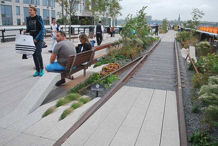
Close-up of the railroad track with crossties incorporated into the High Line pedestrian walks; 10.15.14.
Consistent with the High Line’s commitment to incorporating public art, there is a series of sculptures by Adrian Villar Rojas, “The Evolution of God,” 2014. He has sited 13 concrete and clay composite cubes within the vegetation. As they weather, the cubes about 4 feet on a side will decompose and become more and more a part of the natural, self-seeded landscape. These sculptures do have a rugged quality suggestive of concrete elements of highway or railroad construction. As large elements in the foreground, they even remind me of the foreground elements of shakkei gardens, hidden scenery Japanese landscapes. However, the explanatory text posted by the sculptures overstates matters:
“For the High Line, the artist presents a new, site-specific sculptural installation composed of thirteen abstract sculptures which punctuate the wild, self-seeded landscape of the High Line at the Rail Yards, and creates a sculptural progression and a rhythmic sequence of forms, reminiscent of a musical score. The project integrates organic elements such as seeds, vegetable, and other perishable components inspired by the natural landscape on the High Line. Seemingly sturdy, the sculptures will instead turn into living organisms, revealing the passage of time through vegetal sprouts and tectonic cracks, which will slowly return the sculptures to the surrounding landscape.”
There is a nice sense of unity as a result of the repetition of these 13 elements in the High Line’s landscape. However, it seems an exaggeration to call them scoring in music or living organisms. See Lawrence Halprin’s RSVP Cycles for some much more integrated examples of music and scoring elements. Concrete and clay are inorganic elements, and it’s not as if the sculptor has created a new life form, although the sculptures may host, in time, a community of plants and animals.
At West 30th Street the High Line makes a sharp turn eastward and moves parallel to this street. There is another monumental bench at a widening in the path at this turning point, and then the same pathway continues towards 11th Avenue. There is a large arrival space extending the full width of the trestle with signage describing the High Line and a transition to the pavements and details associated with the earlier phases of design: concrete planks with curved tines integrated with railroad tracks; the integrated, curved concrete benches; the LED guardrails, and so on.
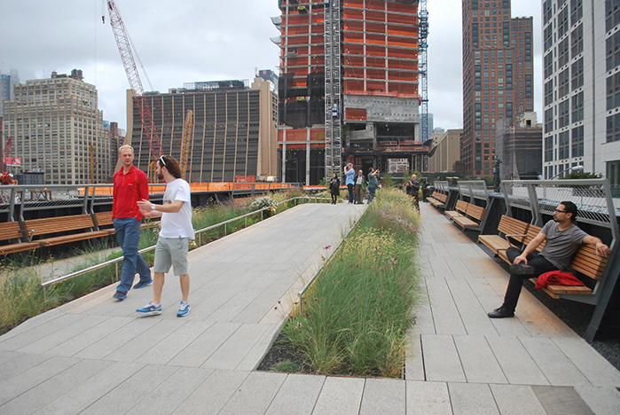
A view looking east along the Interim Walkway where it starts to parallel West 30th Street; 10.15.14.
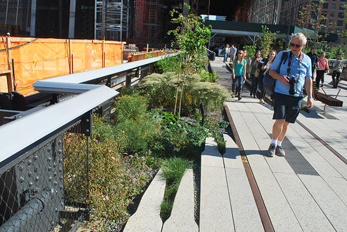
A close-up view of the placement of the concrete tines in order to minimize conflicts with pedestrians but still integrate into the plank and rail walk system; 10.17.14.
In this entire section the placement of the tines seems more thoughtfully calculated so that they are located not only to integrate with the concrete planks and steel rails, but also to minimize pedestrian conflicts. So far there are also limited areas where the knee-high cables seem to be necessary. At either side of the large landing area, there are strong but recessive gates so that this could be a temporary terminus to the High Line if for some reason, say during future construction projects for the Hudson Yards, the balance of the walk had to be closed temporarily. If closure occurred, a new staircase at 11th Avenue and West 30th Street would be a convenient access point.
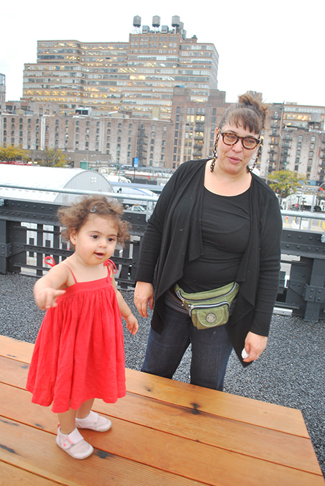
Mother and child enjoying the large-scale bench in the Interim Walkway near 30th Street; 10.15.14.
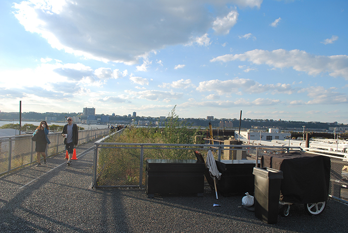
The “landing” where the Interim Walkway widens to a pedestrian space for the full width of the High Line trestle and connects to more typical vocabulary; 10.08.14.
On the north side of the High Line is a children’s play area called Pershing Square Beams. There is a transition to a soft, rubberized pavement and a network of undergrounds spaces for children to play in as supervised by adults. The design includes a covered skylight that pokes through the plantings in an adjacent section and allows children to go through the tunnel and look at their surroundings from a gopher’s perspective. It seems to have attracted a lot of attention from adults walking by, as this is one of the few sections in the newer plantings in which people are encroaching into the landscape where they should not.
Therefore, this may become a location where more than the knee high cables are required to keep people from damaging the plantings. A set of restrooms would have been particularly useful within or near the children’s playground, as there is no nearby facility. There seems a risk that the children could soil the very environment in which they are intended to recreate. Clivus Multrums or some other composting or self-disposing toilet would still be a useful addition, both for its practical benefits and also as an educational example to the public.
At the southwest side of 11th Avenue and West 30th Street is a large, beautifully scaled pedestrian staircase. From the High Line it rises first to a viewing platform, and then descends to the street. The increased pedestrian activity is already generating increased business activity at the street level. I observed one deli/food store at the SE corner doing a booming business in sandwiches and salads to go.
As one continues east on the section of the High Line parallel to West 30th Street, the planked pavement arches upward to a high point in the center of the bridge over 11th Avenue. Two narrower planked pavements lined with long linear wood benches with wood and metal backs built into the guardrail of the trestle continue at the same level on either side, and sloped planting beds between the ramped section and the flat sections are planted lavishly with perennials and grasses. The ramping achieves a dual purpose: it emphasizes the views from the bridge and it creates quieter spaces on either side.
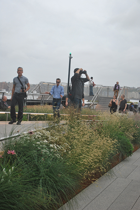
The centerpoint of the bridge over 11th Avenue with the raised pavement in the center and flat walks on either side with the steps down to the street in the background; 10.15.14.
In fact, one of the few places I’ve ever observed a person sleeping was along one of these benches, as the change in elevation is just enough to create a separate space removed from the busier “thoroughfare” of pedestrian traffic.
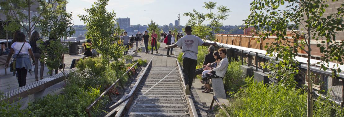
As the High Line continues east there is a imaginative addition to the railroad track vocabulary. Incorporated within the plank pavements on alternating sides of the main route are three sections of railroad track with crossties flush with the walkway surface and the rail elevated to form an edge with the planting beds, reinforced with a low guardrail. Already a game has emerged for pedestrians to walk along the rail edge to test their sense of balance.
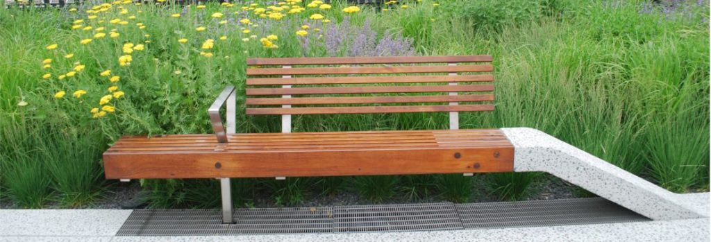
In this same section are a few of the typical integrated bench designs, but also some much longer benches of the same design and also a few benches with tables, which appear ideal for picnicking or other similar activities. The plantings are typical of other sections of the High Line, grasses and perennials, some bulbs and shrubs and selected trees.
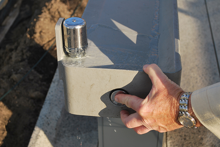
A close-up of new water fountain malfunctioning due to apparent lack of water pressure (see functional shot below under Additional Photos); 10.08.14.
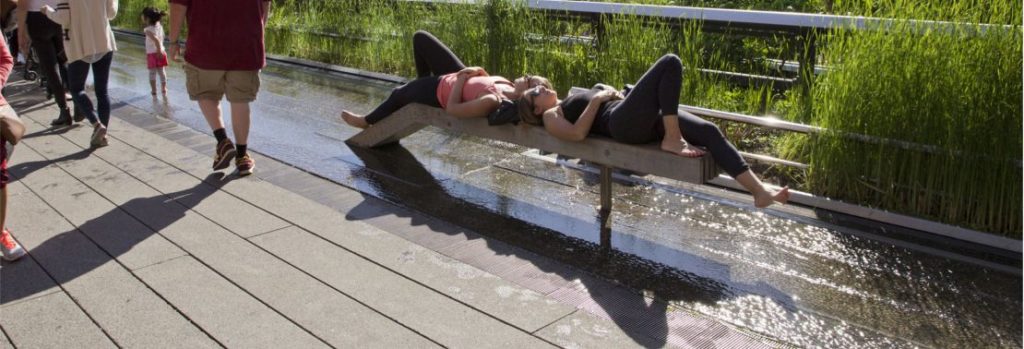
There is also a new type of water fountain, although the one which I tried did not always function properly apparently due to a lack of water pressure. Instead of a steady stream of water from the top of a column that projects above the basin, there was a mere gurgling of water at the base.
In the midst of this section is what’s called the 30th Street Grove. However, the geometry of the grouping is more of a row. I counted five Kentucky coffee trees (Gymnocladus dioicus) planted in a row, and like the much more numerous group of maples by the 10th Avenue Square, the trunks rise through the small openings in the pavement. However, these trees are not afforded the protection of benches and dense spacing, so appear quite exposed.
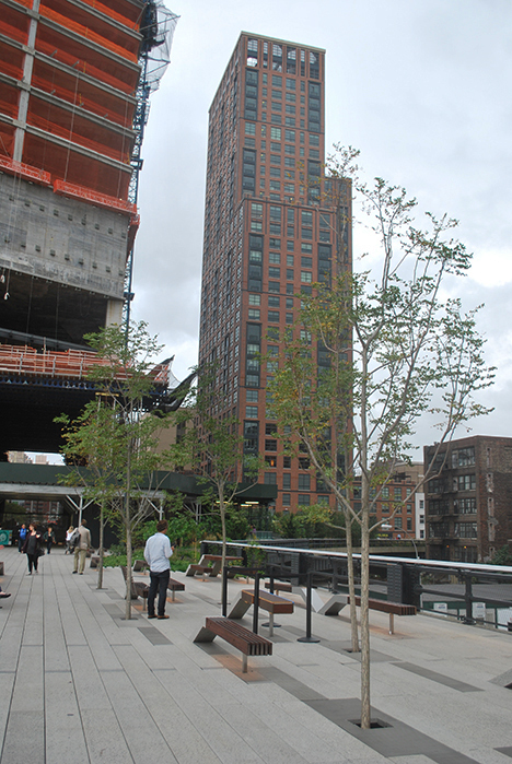
A view looking east towards a row of Kentucky coffee trees with the Hudson Yards under construction in the background; 10.15.14.
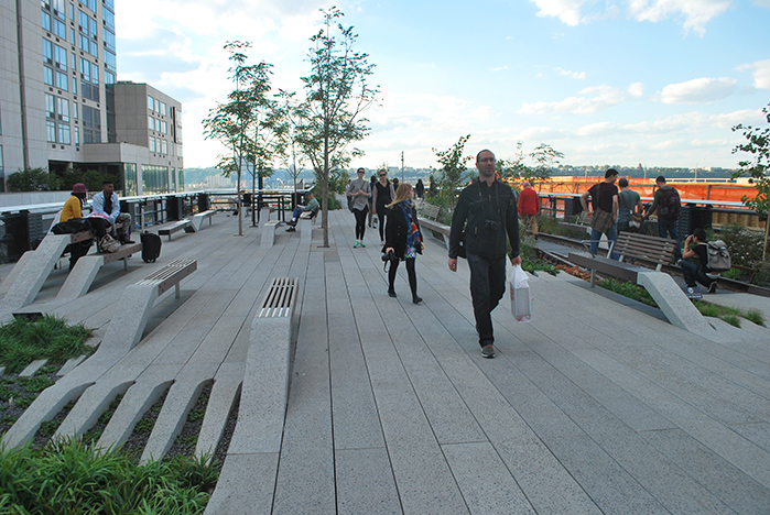
A grove of Kentucky Coffee trees in the middle of the High Line by West 30th Street. The tines treatment of concrete planks has been configured in a way to minimize pedestrian conflicts; 10.08.14.
On one of my excursions, I noticed a man leaning heavily on the trunk/branch of one of these trees as he was surveying his surroundings. I believe I noticed some additional trees of the same species, but the placement and spacing lack a sense of character. Perhaps, as these trees grow and gain canopy and stature, there will be a more promising definition of space.
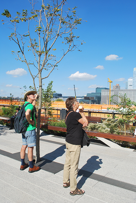
Pedestrian holding onto a branch of a Kentucky coffee tree; 10.17.14.
As one continues walking eastward, the mass of the first major commercial building of Hudson Yards rises prominently. At some point pedestrians will be able to continue directly into this building, but now there is a barrier and the High Line turns at a sharp angle to the right, or southeast, and connects with the end of the second phase. Within the plank system are railroad track sections which imitate this angle exactly, and also one prominently placed bench in which two seating sections intersect with each section aligning with the existing and new route.
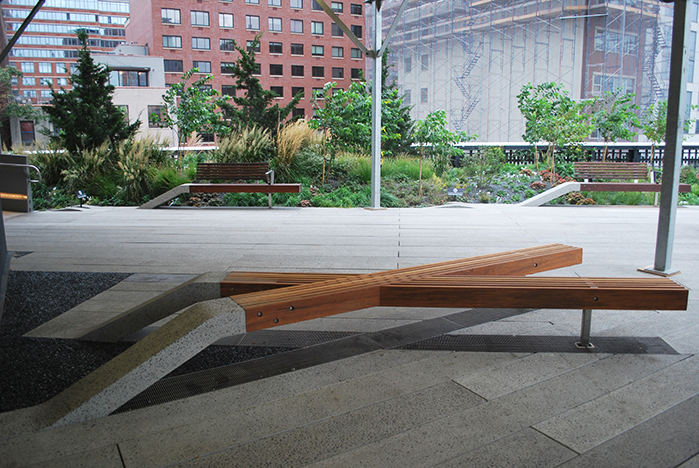
The integrated design of the crossroads bench at the location where Phase Three meets Phase Two and the Hudson Yards development; 10.15.14.
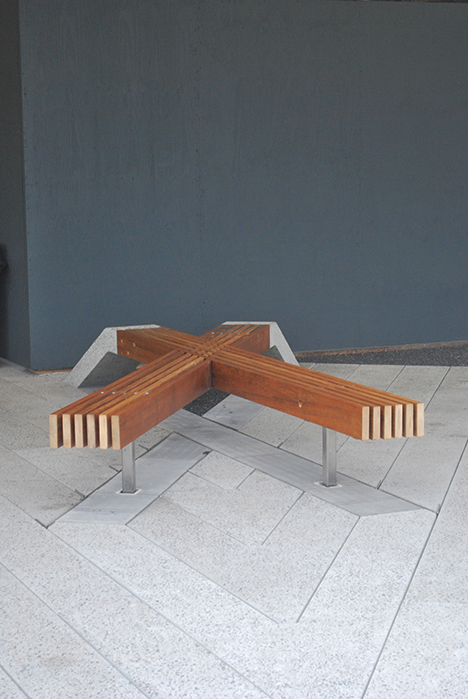
Another location of the integrated design of the crossroads bench; 10.15.14.
Due to the unfinished construction all around, it’s difficult to gauge the effectiveness of this symbol of a crossroads, although the bench is certainly comfortable and consistent with the previous High Line vocabulary. The plank paving continues to the 30th Street Cutout and Viewing Platform over the exposed steel construction of the trestle, which is the end of the second phase.
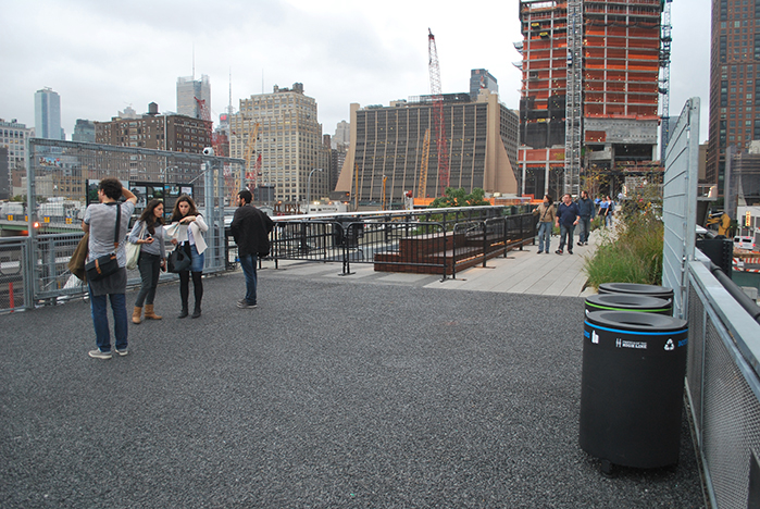
At the 30th Street Cutout and Viewing Platform the Interim Walkway terminates at a wide landing which transitions to the more typical High Line vocabulary. Gates on either side could be locked to block access during future construction activities on the Hudson Yards; 10.15.14.
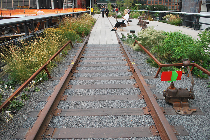
A close-up view looking east of the railroad track pavement; 10.15.14.
Just as with earlier sections of the High Line, the views walking in one direction are quite different from those experienced walking in the other direction. It’s a striking experience to walk northward near the end of the second phase and then turn sharply left (westward) as one approaches the beginning of the third phase with views abounding of the Hudson Yards under construction and the vast rail yards in the distance. I don’t think New Yorkers have ever seen previously such a striking view of the infrastructure of their own city.
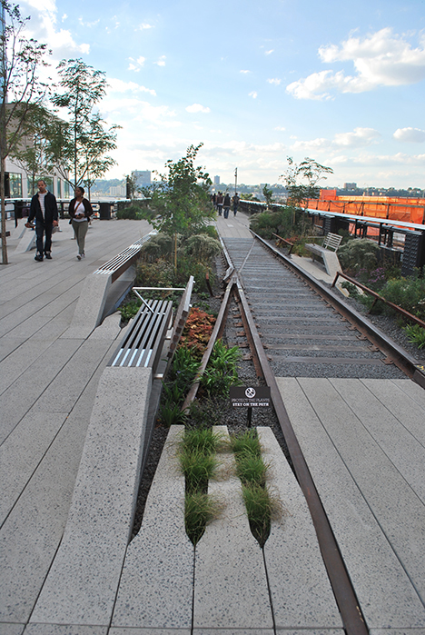
A view of a railroad track with switch located closer to the Crossroads where Phase Two and Three meet by the entrance to one of the first buildings being constructed for Hudson Yards. 10.08.14.
Normally, infrastructure is hidden underground or associated with tunnels, sewers and rats. By emphasizing the walking surface of the High Line one story up with the views down towards train after train after train, the designers have made the infrastructure highly visible. It will be interesting to see over time as Hudson Yards continues to be developed what impact it will have on the consciousness of urban design in the city.
The detailed design of Phase 3 is generally consistent with the conceptual designs presented several years earlier, and there have been some improvements. For example, the use of Kentucky coffee trees, instead of the grove of honey locusts suggested earlier, is a much more unusual and original choice. It also is sensible to have kept the design of the walk system simple as it wraps around the site of the Hudson Yards since so many details of how the two designs would dovetail and integrate would haven taken many design charrettes to resolve. The simple aggregate pavement which can easily be removed or patched is a good choice.
Similarly, the decision not to painstakingly clean, repair and re-build the guardrail on the Hudson Yards side of the trestle seems quite practical because there may need to be many connecting routes through it from the buildings, plazas, and pedestrian networks of the Hudson Yards. However, the lack of an additional elevator or even one restroom over the full length of this third phase and the lack of more extensive plantings (even given the self-seeded areas) suggests that the funding is not as readily available as was the case for the first two phases.
Perhaps, because the opening of the third phase signals that the major design work on the High Line is finished, the website of www.thehighline.org has undergone some major changes. No longer can one find a section of photographs documenting design and construction, a series of detailed maps, and other highly useful features. There is more focus on gaining new memberships and selling merchandise, and providing a day-to-day calendar of events. These changes may also be indicative of a slowing down of the funding stream, as it no doubt cost a great deal of staff time to maintain images of the entire duration of the High Line design and construction process, edit photos of plant materials and other elements, keep updating responses to frequently asked questions, and so on.
There is, of course, still time to add elevators and restrooms to the infrastructure, but it will take finesse and finances to integrate them in an integral manner into the existing design. The prominent fund-raising features of the revised website may help with this task. This last phase certainly has the potential to affect and impact its surroundings as profoundly as the earlier phases have.
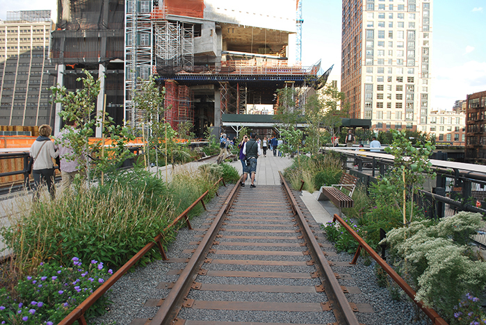
A new railroad track walk design as the High Line approaches Hudson Yards and the end of Phase Two; 10.08.14.
Additional High Line As-built Third Phase Photos
That’s it for now. I hope that these different sections of text and images of the High Line will generate discussion.
Come back next time for my final installment, Part 14, the Conclusion of “A Comparison of the Three Phases of the High Line, New York City: A Landscape Architect and Photographer’s Perspective.”
Steven L. Cantor
Photos © Steven L. Cantor are available for individual purchase.
Cumulative 14-part “A Comparison of the Three Phases of the High Line, New York City: A Landscape Architect and Photographer’s Perspective” Series End-notes
1. Ulam, Alex. “Back on Track,” Landscape Architecture Magazine. Volume 99, No. 10, October, 2009, p. 97.
2. http://www.thehighline.org/news/2012/01/24/major-milestone-for-the-high-line-at-the-rail-yards
3. http://www.thehighline.org/sustainability
4. http://www.thehighline.org/design/planting
5. Ulam, Alex. “Back on Track,” Landscape Architecture Magazine. Volume 99, No. 10, October, 2009, p. 97 and 105-106. He refers to an article in the New York Post.
6. David, Joshua, Reclaiming the High Line, a project of the Design Trust for Public Space with Friends of the High Line. Karen Hock, editor, (New York, Ivy Hill Corporation and others, 2002). p.7.
7. http://www.thehighline.org/about/ask-a-gardener
8. http://untappedcities.com/2013/10/17/live-blog-from-2013-mas-summit-for-nyc-day-1/
http://untappedcities.com/2012/04/26/partners-in-preservation-the-high-line-section-3/
http://untappedcities.com/2013/11/13/spur-the-third-section-of-the-high-lines-crown-jewel-a-nest-in-the-sky/ (by Bhushan Mondkar)
9. http://www.thehighline.org/sustainability and http://www.thehighline.org/about/faq
10. http://www.thehighline.org/about/faq
11. Cantor, Steven. Green Roofs in Sustainable Landscape Design. (New York, WW Norton, 2008). p. 34 (Several additional definitions are provided. It is possible to measure sustainable elements precisely, from carbon footprints to other calculations, but that is beyond the scope of this discussion.)
12. http://www.thehighline.org/sustainability
13. http://ticcih.org/wp-content/uploads/2013/04/ticcihbulletin55.pdf is just one example, from the International Committee for the Conservation of the Industrial Heritage.
Publisher’s Note:
See Steven L. Cantor’s ENTIRE 14-part “A Comparison of the Three Phases of the High Line, New York City: A Landscape Architect and Photographer’s Perspective” Series.
Steven L. Cantor, Landscape Architect
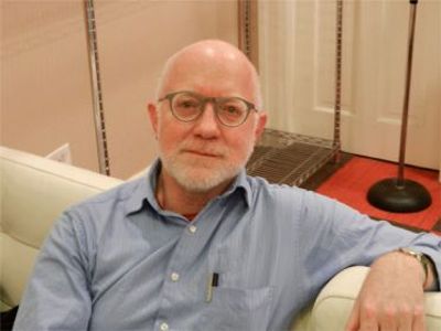
Photo by Thomas Riis.
Steven L. Cantor is a registered Landscape Architect in New York and Georgia with a Master’s degree in Landscape Architecture from the University of Massachusetts, Amherst. He first became interested in landscape architecture while earning a BA at Columbia College (NYC) as a music major. He was a professor at the School of Environmental Design, University of Georgia, Athens, teaching a range of courses in design and construction in both the undergraduate and graduate programs. During a period when he earned a Master’s Degree in Piano in accompanying, he was also a visiting professor at the College of Environmental Design at the University of Colorado, Boulder. He has also taught periodically at the New York Botanical Garden (Bronx) and was a visiting professor at Anhalt University, Bernberg, Germany.
He has worked for over three decades in private practice with firms in Atlanta, GA and New York City, NY, on a diverse range of private development and public works projects throughout the eastern United States: parks, streetscapes, historic preservation applications, residential estates, public housing, industrial parks, environmental impact assessment, parkways, cemeteries, roof gardens, institutions, playgrounds, and many others.
Steven has written widely about landscape architecture practice, including two books that survey projects: Innovative Design Solutions in Landscape Architecture and Contemporary Trends in Landscape Architecture (Van Nostrand Reinhold, John Wiley & Sons, 1997). His book Green Roofs in Sustainable Landscape Design (WW Norton, 2008), provides definitions of the types of green roofs and sustainable design, studies European models, and focuses on detailed case studies of diverse green roof projects throughout North America. In 2010 the green roofs book was one of thirty-five nominees for the 11th annual literature award by the international membership of The Council on Botanical & Horticultural Libraries for its “outstanding contribution to the literature of horticulture or botany.”
Steven’s most recent book is Professional and Practical Considerations for Landscape Design (Oxford University Press, 2020) where he explains the field of landscape architecture, outlining with authority how to turn drawings of designs into creative, purposeful, and striking landscapes and landforms in today’s world.
He has been a regular attendee and contributor at various ASLA, green roofs and other conferences in landscape architecture topics.
In recent years Steven has had more time for music activities, as a solo pianist and accompanist. In 2011 he performed a solo piano program at the Winter Rhythms festival at Urban Stages Theater. He’s a regular performer at musicales hosted in Chelsea and other settings in Manhattan. On August 25, 2013, Leonard Bernstein’s birthday, he performed with Stephen Kennedy Murphy a program of excerpts from the composer’s MASS and Anniversaries.
Steven joined the Greenroofs.com editorial team in December, 2013 as the Landscape Editor. In February, 2015 he completed his 14-part series “A Comparison of the Three Phases of the High Line, New York City: A Landscape Architect and Photographer’s Perspective.”
 Greenroofs.comConnecting the Planet + Living Architecture
